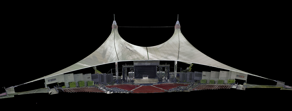
3D Laser Scanning for As-Built Documentation: Choosing the Right Deliverable
When a renovation, retrofit, facility project, or complex existing space needs reliable documentation, the question is rarely just whether to scan. The more useful question is: What does the project team need to do with the information after capture?
3D laser scanning can document existing conditions as dense spatial data. Depending on the agreed scope, that information may support a point cloud, drawings, a model, a BIM-oriented workflow, or a visual-review environment. The right deliverable depends on the design, construction, operations, or verification decision the team needs to make.
This guide helps project teams plan 3D laser scanning for as-built documentation before they request scope.

Key idea: Define the downstream use before choosing the deliverable. A point cloud, 2D drawing, 3D model, and review environment solve different problems. They should not be treated as interchangeable.
What “as-built documentation” means in practice
As-built documentation describes existing conditions for a project team. It is useful when the team needs to understand a space, coordinate work, plan a change, document an asset, or compare information during a defined project phase.
The final scope should distinguish between documenting what exists and creating a design for what will be built. It should also identify the agreed coordinate reference, required level of detail, required file format, and the people who will use the information.
When 3D scanning may be useful
Scanning can be considered when conventional measurements alone may not give a project team the context it needs. Common planning situations include renovations, retrofits, complex interiors, industrial or equipment areas, facilities with many interconnected elements, and spaces where existing conditions need to be communicated to several stakeholders.
That does not mean scanning is the right solution for every project. The area to capture, access, safety conditions, project schedule, downstream use, and required outputs should guide the recommendation.
Choose the deliverable around the project question
Project question | Potentially useful output | What to confirm before scope is set |
What exists in the space today? | Registered point-cloud data or a visual-review environment | Area, access, scan coverage, coordinate system, and required detail |
How will the design team work from existing conditions? | 2D linework or drawings derived from captured data | Elements to document, drawing standard, level of detail, and file format |
Does the team need modeled objects? | A 3D model or BIM-oriented deliverable | Modeling detail, software/file format, coordination requirements, and intended use |
Will multiple people review the conditions? | A review-ready data or viewer workflow | Users, access, measurement or annotation needs, and retention expectations |
Is the project documenting a complex facility? | A phased or combined documentation approach | Areas, equipment, access constraints, project phases, and downstream use |
The outputs above are examples for discussion. The final deliverable should be confirmed for the project rather than assumed from the word “scan.”
What happens during a typical planning process
A useful planning model has four parts:
Define the area and purpose. Identify the spaces, assets, project phase, and decision the information must support.
Plan capture around the site. Discuss access, active operations, safety requirements, scheduling, restrictions, and coordinate needs.
Review the captured information. Confirm the agreed coverage and determine how the data will be organized for the planned deliverable.
Produce the agreed output. Deliver the information in the format and level of detail identified in scope.
Actual project workflows vary. This is a planning framework, not a guarantee that every project follows the same sequence or receives every type of output.
What to send with a 3D-scanning request
The first request does not need every technical answer, but it should give the team enough context to scope the project intelligently:
Project location and the areas to document
The project purpose: design, renovation, coordination, operations, verification, or another defined need
Existing drawings, models, coordinates, or file standards
Required software or delivery formats, if known
Site access, active-work, safety, security, and scheduling constraints
The project deadline and people who will use the output
Avoid a common mistake: asking for “a scan” without defining the use
A scan is data capture, not automatically a finished drawing, model, or deliverable. Defining the purpose first helps the project team avoid asking for information it cannot use—or overlooking an output it actually needs.
Before a project begins, confirm the agreed deliverables, file formats, coverage, detail, coordinate-system handling, and review process. Do not rely on a generic list of possible outputs in place of a project-specific scope.
Discuss 3D laser scanning for as-built documentation
SurvTech Solutions can discuss the area to document, intended use, access constraints, coordinate needs, and delivery format. The final scope should identify the specific service and deliverable appropriate for the project.