SurvTech Solutions: Drones and Surveying
- Emily Falcone
- Oct 12, 2023
- 3 min read
In the rapidly evolving world of construction and land development, precision and accuracy are paramount. That's why Drones and Surveying, as well as Helicopters and Aircraft are perfect for the Surveying Operations that you may need!
Aerial Mapping with Drones and Surveying with Helicopters
The ability to capture detailed, up-to-date, and comprehensive aerial data is crucial for informed decision-making and project success.
SurvTech Solutions, a trailblazer in the field of surveying and geospatial services, has harnessed the power of cutting-edge technology to offer aerial mapping solutions using drones and planes. In this article, we'll explore how SurvTech Solutions leverages aerial mapping to provide invaluable insights for a wide range of industries.


A New Perspective: The Power of Aerial Mapping
Traditionally, surveying and mapping involved ground-based techniques that could be time-consuming and limited in scope. But then, you add Drones, and surveying becomes a brand new ballgame. Aerial mapping also gives you a revolutionary approach to data collection, delivering benefits that include:
Unparalleled Coverage
Aerial mapping provides a bird's-eye view of vast areas, allowing for the efficient and rapid collection of data over large expanses of land. This is particularly valuable for industries like agriculture, forestry, and urban planning.
Get an Aerial Map of your Project with SurvTech Solutions
High Precision
Drones and surveying go together. Also, our planes and helicopters are equipped with advanced sensors and cameras capture data with exceptional precision. This level of detail is crucial for engineering, construction, and environmental monitoring projects.

Real-Time Data
Aerial mapping can provide real-time or near-real-time data, allowing project managers and decision-makers to respond quickly to changing conditions or emergencies.
Safety and Efficiency
Aerial mapping reduces the need for personnel to be physically present in challenging or hazardous environments, enhancing safety and efficiency in data collection.
Versatility
Aerial mapping is highly versatile, making it applicable to a wide range of industries, including agriculture, construction, environmental conservation, and disaster management.
SurvTech Solutions' Aerial Mapping Services
SurvTech Solutions has embraced the potential of aerial mapping, and their services in this domain are nothing short of transformative. Here's how SurvTech Solutions utilizes drones and planes to deliver exceptional results:
Drones and Surveying with Aerial Mapping


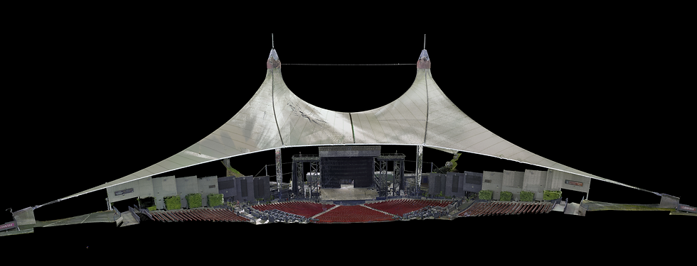
SurvTech Solutions employs state-of-the-art drones equipped with high-resolution cameras and LiDAR technology. These drones are capable of capturing detailed imagery and topographical data with remarkable accuracy. Applications of drone-based mapping include:
Construction Monitoring: Tracking progress and ensuring compliance with project blueprints.
Environmental Monitoring: Assessing ecological changes and impacts on natural landscapes.
Agriculture: Optimizing crop management and yield through precision agriculture techniques.
Land Surveying: Creating detailed topographic maps for land development projects.
Plane-Based Aerial Mapping
SurvTech Solutions also utilizes fixed-wing aircraft equipped with cutting-edge mapping sensors. Plane-based aerial mapping is ideal for large-scale projects that require extensive coverage and high-resolution data. Key applications include:
Utility Infrastructure Inspection: Mapping and monitoring power lines, pipelines, and other critical infrastructure.
Flood Modeling: Gathering data to predict and mitigate the impact of flooding events.
Forestry Management: Assessing forest health, tree density, and growth patterns.
Urban Planning: Supporting city planners with data for smart growth and development.
Helicopter-Based Aerial Mapping

SurvTech Solutions also utilizes Helicopters equipped with cutting-edge mapping sensors. Plane-based aerial mapping is ideal for large-scale projects that require extensive coverage and high-resolution data. Key applications include:
Utility Infrastructure Inspection: Mapping and monitoring power lines, pipelines, and other critical infrastructure.
Urban Planning: Supporting city planners with data for smart growth and development.
SurvTech Solutions has embraced the future of surveying and geospatial services through its innovative aerial mapping solutions. By harnessing the capabilities of drones, planes and helicopters . SurvTech Solutions provides a new perspective on data collection, analysis, and decision-making.
Their commitment to precision, accuracy, and versatility makes them an invaluable partner for industries ranging from construction and agriculture to environmental conservation and disaster management. With SurvTech Solutions, the sky is not the limit; it's just the beginning.
Get an Aerial Map of your Project with SurvTech Solutions