The Future of Geopositioning: Digital Twins
- David O'Brien
- Aug 4, 2021
- 2 min read
Updated: Mar 14, 2022

Digital Twin is a term everyone should be paying attention to. This technology is going far and fast. However, we are only in the beginning stages of learning the Digital Twins potential, like where we were with GPS in the late ’80s. Back then GPS units were the size of a suitcase and were powered by car batteries. Many GPS sessions had to be performed at night, due to the lack of satellites in the constellation. So, if you asked the average person what GPS was, no one had a clue, except maybe pilots and an occasional boat captain. Now you look around everyday America and you see GPS in every aspect of life, including automobiles, cell phones, and even watches.
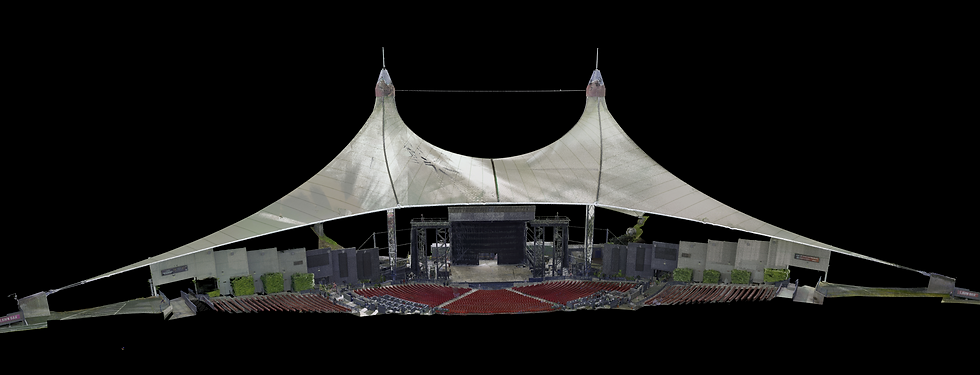
Just like GPS, Geopositioning is just an everyday part of our life now. However, it all started with the military and surveyors over 30-years ago. Most people have probably never even heard of a digital twin, but we all know what an online or digital avatar is. A digital representation of yourself. A digital twin is the exact digital representation of an item from the physical world, whether it is a person, a building, a tree, a project site, or maybe even the entire world someday. Just like with the invention of GPS, we are now seeing LiDAR and 360° working together to create a virtual reality. LiDAR (laser scanning) has been around for over 20+ years, but with the increase of computing speed and data transmission speeds, we now can work with large LiDAR point clouds and imagery datasets. By collecting millions and billions of points that can be accurate to millimeters and draping these 3D points with color imagery, we are creating digital twins of industrial plants, commercial buildings, factories, residential buildings, and project sites. We are now performing LiDAR from planes, UAVs, cars, boats, tripods, and even mobile backpack units that utilize the SLAM (simultaneous localization and mapping) algorithm for positioning. End users can now visit a site virtually and view it in 3D from thousands of miles away.

This 3D virtual world is quickly becoming the base map or backbone of information systems. So not only can you now have a digital twin of your building or site, but you can have information stored about every item in that building or site, that can be accessed through that 3D graphical interface. Information such as the type of equipment, when was it installed, when was it serviced, who serviced it, when is the end of life, startup, and shutdown procedures, how much did it cost, etc. The point is, now we can view information about the real world, in the digital world, and from anywhere with an internet connection.
The creation of digital twins will become the interface for information systems in the years to come. No longer will there be a need to query databases with words, but it will be visually gathered from the item itself. Not in the physical world, but the digital world. Who knows, in 20 years we may be writing an article about a new technology and talking about digital twins, as an everyday item in our lives.