New Additions to the UAV Toolbox
- Mark Bickel
- Oct 4, 2021
- 2 min read
Updated: Nov 12, 2024

The UAV Department is excited to be adding to our equipment collection! This month we added a Ladybug 360-degree camera to supplement our mobile LiDAR capabilities as well as our first fixed-wing VTOL drone, a Wingtra Gen II. All of these tools will allow us to broaden our offerings of services provided. Learn how these tools are helping us to expand our capabilities!
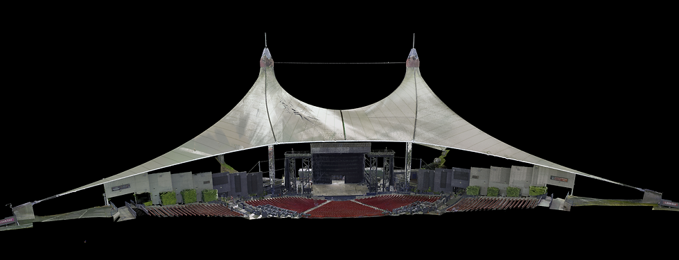
The Ladybug 360-degree camera system is the perfect complement to our mobile scanning technology. When paired with our Reigl VUX-1, we can provide unparalleled precision in the form of a colorized point cloud. Fans of LiDAR and terrestrial scanning will be impressed with the level of detail that is captured. With this technology, comprehensive data can be collected and integrated with traditional survey methods for right-of-way surveys, utility planning, and even mobile scanning of areas such as golf courses and racetracks for use in the creation of video game environments.

The Wingtra Gen II is a state-of-the-art mapping drone, which provides us the capability of a wide range of photogrammetry options. We obtained three cameras with our new drone, a Sony RX1 RII, a 42MP camera for high precision photos capable of 1.5cm GSD from a flight altitude of 400ft AGL, as well as an oblique camera (Sony a6100) that gives us the ability to produce high-resolution 3D models. We also added a multispectral camera with an integrated thermal sensor that can map many applications, such as agriculture, forestry, environmental research, and water management. We are happy to have this new addition to our fleet. Under normal operating conditions, with the 42MP Sony RX1 PPK camera system, we are capable of covering 500+ acres in just one flight at 1.5cm per pixel for resolution!
Talk to SurvTech Solutions about using the latest technology to scan your project for the most accurate surveying results.
Want to learn more about increased capabilities with Wingtra accessories? Check out our article on the Wingtra RGB61 Camera