Aerial Mapping Case Studies
- Emily Falcone
- Nov 9, 2023
- 4 min read
Updated: Apr 2, 2024
In Urban Planning, Environmental Conservation, and Infrastructure Inspection
In the dynamic realm of geospatial services, the ability to capture and analyze data with precision and efficiency is paramount.


SurvTech Solutions, a leading provider of surveying and mapping services, has consistently demonstrated their expertise through a series of remarkable aerial mapping case studies.
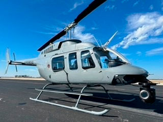
In this article, we will explore real-world examples of how SurvTech Solutions harnesses the power of aerial mapping to deliver exceptional results with their specialized UAV's
Case Study 1: Urban Planning and Development with Aerial Mapping
A major urban planning initiative necessitated in-depth aerial mapping and analytical support to guide decisions on sustainable development and zoning.

The project spanned a vast area with diverse terrains and land uses, presenting a unique challenge. To meet this, SurvTech Solutions utilized their sophisticated aerial mapping tools, including cutting-edge LiDAR sensors and high-resolution imagery.
The team at SurvTech Solutions undertook extensive aerial surveys, leveraging their aerial mapping expertise to accurately gather data on various aspects such as land use, vegetation patterns, and the topography of the region. This data was meticulously captured through their aerial mapping technology, ensuring detailed and reliable information.
To process and interpret this wealth of data, SurvTech Solutions employed advanced Geographic Information Systems (GIS) software. This step was crucial in transforming the raw data gathered through aerial mapping into actionable insights. The aerial mapping proficiency of SurvTech Solutions played a pivotal role in providing land surveyors or urban planners with a comprehensive view of the area under consideration.
This bird's-eye perspective was instrumental in facilitating informed and strategic decisions regarding zoning laws, the development of essential infrastructure, and the integration of green spaces. The project, supported by SurvTech Solutions' aerial mapping acumen, proceeded with unmatched precision and efficiency, perfectly aligning with the objectives of sustainable urban development.
Case Study 2: Environmental Conservation
In facing the challenge of monitoring a critical wildlife habitat, a conservation organization turned to the proven expertise of SurvTech Solutions for a solution.
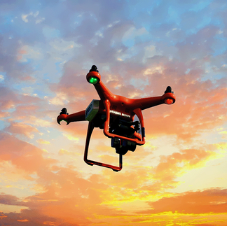
The task: to assess the impact of human activities on the ecosystem through precise observation. The method chosen was both innovative and effective — regular aerial mapping surveys using drones equipped with high-resolution cameras and LiDAR sensors.
This data collection, integral to understanding the habitat, included key indicators like vegetation density, wildlife populations, and habitat alterations. The use of aerial mapping, a core strength of SurvTech Solutions, allowed for an in-depth and comprehensive analysis of the ecosystem.
Applying advanced image analysis techniques to the collected data was a game-changer. This crucial step enabled the identification of subtle yet significant changes over time, offering a detailed and accurate picture of the habitat's evolving state.
The insights gleaned from these aerial mapping efforts were invaluable, providing a clear and actionable view of the habitat. Armed with this information, the organization was able to implement targeted interventions to effectively protect the ecosystem and its inhabitants. This success story underscores the pivotal role of aerial mapping in environmental conservation, showcasing how technology can be harnessed for the greater good of our planet.
Case Study 3: Infrastructure Inspection
The Challenge: A state transportation agency needed to assess the condition of a network of bridges and highways. Traditional ground inspections were time-consuming and posed safety risks. SurvTech Solutions employed aerial mapping using fixed-wing aircraft equipped with LiDAR sensors and high-resolution cameras.
These surveys covered extensive stretches of roadways and bridges, capturing detailed data on infrastructure conditions. Advanced LiDAR analysis was used to detect structural anomalies. SurvTech Solutions' aerial mapping expedited infrastructure assessments and reduced risks associated with ground inspections. The transportation agency gained accurate insights into maintenance needs and prioritization, resulting in cost savings and improved road safety.
The Challenge: A state transportation agency was confronted with the significant task of assessing the condition of an extensive network of bridges and highways. Traditional ground inspections, while thorough, were not only time-consuming but also posed considerable safety risks to inspectors.
In response to this challenge, SurvTech Solutions stepped in with an innovative approach, employing aerial mapping. This technique utilized fixed-wing aircraft, strategically equipped with LiDAR sensors and high-resolution cameras, to comprehensively survey the infrastructure.
These aerial surveys, a testament to SurvTech Solutions' commitment to technological innovation, covered extensive stretches of roadways and bridges. They were instrumental in capturing detailed and precise data on the infrastructure and sub-surface conditions, far beyond what traditional methods could achieve. This data included subtle yet critical aspects of structural integrity, often missed in standard inspections.

Advanced LiDAR analysis, a cornerstone of SurvTech Solutions' methodology, was then employed to meticulously detect any structural anomalies. This process was not only more efficient but also significantly safer, reducing the need for inspectors to physically access potentially hazardous locations.
SurvTech Solutions' use of aerial mapping expedited the infrastructure assessments dramatically, making the process both faster and more comprehensive. Furthermore, it reduced the risks typically associated with ground inspections, ensuring safety without compromising on thoroughness.
The transportation agency, benefiting from this approach, gained exceptionally accurate insights into the maintenance needs and prioritization of their infrastructure. This level of insight was pivotal in enabling informed decision-making, leading to substantial cost savings and, most importantly, enhanced road safety for the public.

Through this project, SurvTech Solutions not only demonstrated their expertise in aerial mapping but also underscored the value of innovative technology in improving essential public infrastructure management.
Conclusion
SurvTech Solutions' commitment to precision, innovation, and efficiency is evident in their successful aerial mapping case studies. Whether it's supporting urban planning, environmental conservation, or infrastructure inspection, their advanced technology and expertise consistently deliver actionable insights. The use of LiDAR sensors, high-resolution imagery, and GIS analysis positions SurvTech Solutions as a trusted partner in geospatial services, helping clients make informed decisions and achieve their project goals.
For more details on SurvTech Solutions' aerial mapping case studies and their comprehensive range of geospatial services, visit www.survtechsolutions.com. When it comes to elevating precision and efficiency in geospatial services, SurvTech Solutions stands at the forefront, ready to transform your projects into success stories.
Talk to SurvTech Solutions about using aerial mapping for your next project.