Aerial LiDAR and Imagery
- Emily Falcone
- Nov 9, 2023
- 4 min read
Updated: Nov 28, 2023
In today's rapidly evolving technological landscape, businesses across various sectors are in constant pursuit of more precise, efficient, and comprehensive methodologies for data collection and analysis.
SurvTech Solutions, a vanguard in surveying and geospatial services, has adeptly harnessed the advanced capabilities of Aerial LiDAR (Light Detection and Ranging) along with imagery to offer clients an unparalleled depth of insight for their diverse projects. This article delves into how Aerial LiDAR and imagery services provided by SurvTech Solutions yield outstanding results, thereby revolutionizing industry standards.

The Power of Aerial LiDAR and Imagery
Aerial LiDAR and imagery are revolutionizing the way data is collected for a wide range of applications. LiDAR technology, in particular, uses laser pulses to measure distances to the Earth's surface with incredible precision. Combined with high-resolution aerial imagery by helicopter, this technology opens up a world of possibilities in surveying, mapping, and analysis.
SurvTech Solutions' Expertise in Aerial LiDAR and Imagery
SurvTech Solutions has established itself as a trailblazer in the field of geospatial services, and their utilization of Aerial LiDAR and imagery is a testament to their commitment to innovation and excellence.
Aerial LiDAR and imagery are not just tools; they are revolutionary technologies reshaping how we collect and interpret data across a multitude of applications. LiDAR, or Light Detection and Ranging, is particularly transformative. It employs laser pulses to measure distances to the Earth's surface with astounding accuracy.

This precision is pivotal in a variety of critical applications. When this technology is fused with high-resolution aerial imagery, the potential skyrockets. The combination enhances capabilities in key areas such as surveying, mapping, and comprehensive environmental analysis, leading to more informed decision-making and efficient project management.
1. Aerial LiDAR Technology
These sensors emit laser pulses that bounce off the Earth's surface and return to the sensor. By measuring the time it takes for the laser pulses to return, LiDAR technology can calculate precise distances and create detailed 3D maps of the terrain below.
SurvTech Solutions harnesses the latest advancements in LiDAR technology, employing state-of-the-art sensors mounted on various aerial platforms, including both aircraft and drones.
The essence of LiDAR lies in its ability to measure the time each laser pulse takes to bounce back. This precise timing is crucial as it allows LiDAR technology to calculate exact distances with remarkable accuracy. Consequently, this data is transformed into highly detailed, three-dimensional representations of the terrain below.
This process is not only efficient but also provides an unprecedented level of detail in mapping and surveying, setting SurvTech Solutions apart in its field.
2. High-Resolution Aerial Imagery
In conjunction with their advanced LiDAR data collection, SurvTech Solutions also captures high-resolution aerial imagery during their survey flights.
This imagery serves as a valuable complement to the LiDAR data, offering an additional layer of context and visual detail. The incorporation of this imagery is not just an added feature; it is an integral part of SurvTech Solutions' approach to comprehensive data gathering. By blending the precise, three-dimensional data from LiDAR with the rich, visual insights from aerial imagery, SurvTech Solutions is able to provide a more complete and informative view of the surveyed area.
This synthesis of data is particularly invaluable across various applications, offering clients a deeper understanding of their projects through a fusion of quantitative and qualitative insights.
3. Comprehensive Data Analysis
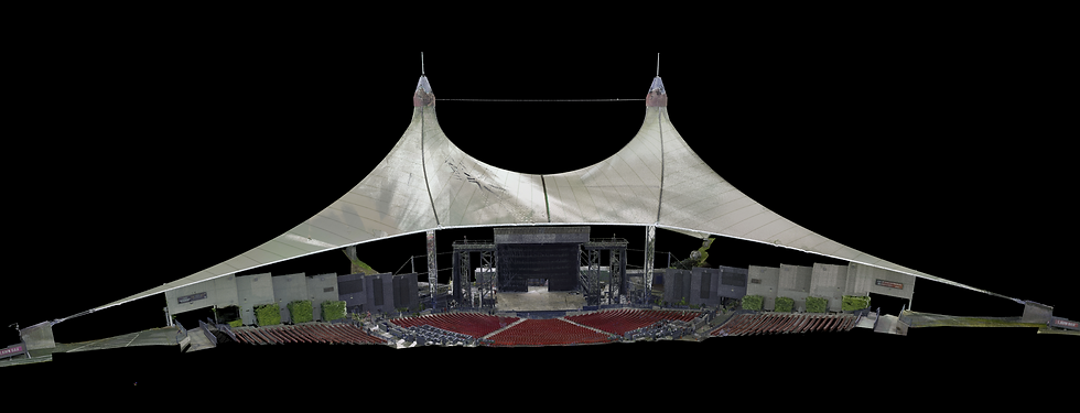
SurvTech Solutions excels not only in the collection of data but also in its meticulous processing and analysis. The company's team, composed of highly skilled experts, employs advanced software tools to transform raw LiDAR and imagery data into actionable insights. Notice the differences here as compared to 3D laser modeling and scanning that you might find on a smaller scale.
This process is a critical step in the value chain offered by SurvTech Solutions.
By carefully processing and analyzing the data, they are able to distill vast amounts of complex information into clear, concise, and practical insights.

These insights are tailored to meet the specific needs of their clients, enabling informed decision-making and strategic planning. This dedication to not just data collection but also to its intelligent interpretation sets SurvTech Solutions apart as a provider of comprehensive geospatial solutions.
4. Versatile Applications
Aerial LiDAR and imagery have a wide range of applications, and SurvTech Solutions caters to various industries, including:
Construction: Monitoring construction progress, assessing site conditions, and ensuring project compliance.
Environmental Conservation: Mapping ecosystems, tracking changes in vegetation, and monitoring wildlife habitats.
Infrastructure: Assessing the condition of roads, bridges, and utility networks.
Forestry: Analyzing forest health, tree density, and timber inventory.
Urban Planning: Supporting city planners with data for development and zoning decisions.
Benefits of SurvTech Solutions' Aerial LiDAR and Imagery
SurvTech Solutions' approach to Aerial LiDAR and imagery offers several key advantages:
1. Precision and Accuracy
LiDAR technology provides incredibly accurate elevation data, making it ideal for applications that require precise measurements.
2. Efficiency
Aerial surveys cover large areas quickly, reducing the time and costs associated with traditional ground-based surveys.
3. Safety
Aerial surveys minimize the need for personnel to be physically present in challenging or hazardous environments, enhancing safety.
4. Real-Time Insights
The data collected can be processed and analyzed rapidly, providing real-time or near-real-time insights for decision-makers.
Conclusion
SurvTech Solutions' integration of Aerial LiDAR and imagery into their suite of geospatial services demonstrates their commitment to innovation and excellence.

By leveraging this cutting-edge technology, they provide clients with comprehensive, accurate, and efficient data that is invaluable for making informed decisions across various industries. When it comes to unlocking the full potential of Aerial LiDAR and imagery, SurvTech Solutions is the trusted partner that can take your projects to new heights.